Holberg
Western Land Anchor of the Pinetree Radar Line
(Republished from the April 1965 issue of The Roundel)
Note – There was an error in the original article, please see “Error Correction” Below.
By Sergeant Bill Johanson
Photos by Corporal Jim Cochrane

RCAF Station Holberg, located on the northwest tip of Vancouver Island, is the western land anchor of the Pinetree radar line which stretches across the nation. Two miles of tangled jungle-like forest and underbrush separate this RCAF community of some 800 souls from the “outside world”, but to the inhabitants who live in semi-isolation, it might as well be 100 miles or more. Yet, more than 50 per cent of the servicemen enjoy the life so much that they apply for extensions to their normal tours of duty.
Just getting to Holberg is a problem. RCAF personnel and dependents, as well as some supplies, are flown as far as the civilian airport at Port Hardy. Here, passengers board buses for a 16-mile trip over a twisting, hump-backed road to Coal Harbour, site of the only whaling factory on the West Coast and a former RCAF wartime base. This is followed by a two-hour voyage on the RCAF vessel Nimpkish II, and a final bus journey from the head of Holberg Inlet to the station itself, a distance of more than four miles over another logging road.
But for the staples of life, the residents of Holberg are dependent on a sea-going barge which brings in supplies and equipment from Vancouver once a week. Milk, bread, fresh vegetables and other foodstuffs and gear are loaded at Vancouver on Mondays and reach Holberg late Thursday nights when the weather is favorable. When storms rake the northern portion of the island, particularly in the winter months, the barge has been known to take as long as 10 days to make the 200-mile trip, leaving little in the larders of the station stores.

Two miles of roadway, slashed through the forest to link up with existing roads to southern Vancouver Island, would terminate Holberg’s dependence on the barge, Nimpkish and aircraft. “We’re hopeful that this year the link will be made,” says W/C H. F. Wenz, RCAF Stn. Holberg’s commanding officer. “The logging roads, designed for use by heavy trucks, would have to be considerably improved for private automobile use. Trucks and buses would also have to be radio-equipped as only one-way traffic is possible on these narrow roads. However, it would be more feasible and ever so much more economical than our present set-up.”
The station’s role is to provide data to the SAGE (semi-automatic ground environment) system of the North American Air Defence Command. Operating 24 hours a day, every day of the year, the base’s equipment scans the skies in its assigned area and reports direct to the Seattle NORAD Sector, located at McChord AFB, Washington, which covers the Province of B.C., Washington State, and parts of Alberta, Idaho and Oregon.
Three radar domes dominate the operations centre, perched on top of Mount Brandes, 2000 feet above sea level and five and one-half miles from the domestic site.
An important secondary task carried out at Holberg is that of search and rescue. During the past dozen years Holberg’s volunteer ground search teams have participated in several SAR missions for persons lost in the bush. One such operation is illustrated by the pictures on this page.
While the men are at work, the women look after their modern homes or apartments and raise families as they do anywhere else in Canada. Community life centres around the recreation building which houses a swimming pool, gymnasium, four-lane bowling alley, library, games room and social centre. The Hudson’s Bay Company store provides a full range of food as well as limited clothing and sundry items. As well as the store and recreation centre, the base houses a bank, post office,
beauty parlor, barber shop, snack bar, and theatre, along with a modern school, hospital and two chapels.

Most service personnel and dependents miss television, which does not reach this far north, and radio reception “from down south” is not too good. However, parents attribute the general improvement of their children’s school grades to the lack of such outside distractions.
Greatest problem facing service people, dependents and civilians, next to the transportation difficulty, is the weather. It rains practically every day, with the average rainfall ranging up to 14 feet or more per year. The forest and streams abound in wild life, making Holberg a hunting and fishing paradise. Soon after the station was built in the early 1950s the local bear population found its garbage dump a bonanza and have been regular visitors ever since, Residents claim that if the temperature should ever increase by only as much as 10 degrees over a sustained period of time, “We’d be living in a tropical jungle here”.
Photo Gallery:


Error Correction
WRONG PHOTOGRAPH
Dear Sir:
Your article on Holberg brought back a bit of nostalgia. Poor Mount Brandes, your air photo of the radar site looks more like Chibougamau, Quebec, (Radar Site).
Mr. E. J. Ludwig,
435 Martha St.,
Burlington, Ontario.
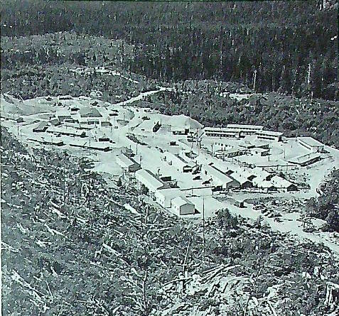
(Mr, Ludwig is correct. As a number of ROUNDEL readers have pointed out, the picture purported to be RCAF Stn. Holberg was in fact, Stn. Chibougamau.)
From page 32 of the June 1945 issue of the Roundel.

That is not the radar towers for Holberg, I know as I was stationed there from 63-65. W/C went was my CO.
Thank you for your comment, I was able to find a correction in a later issue of the Roundel and have added that correction to this page.