Relief Landing Field
Sandhurst
Base / Station: Sandhurst
Province: Ontario
Years in Use:
- Appears to have been expropriated by the Department of Transport and RCAF in 1941.
- 14 June 1944 – 220 acres and buildings on the North West Corner of the Property were turned over to the war assets corporation.
- 4 September 1945 – Remainder of the site was turned over the the Department of Transport.
Use:
- Secondary Relief Landing Field for Kingston, Ontario
Aircraft Types:
Commanding Officers:
Financial Impact: Cost of construction $120,447.51
Buildings:
- 1 x 3 Bay Garage
Date/Reason for Closure/Current Status:
Notes:
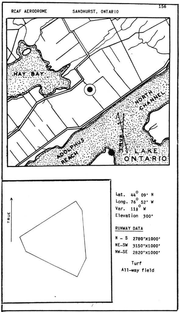
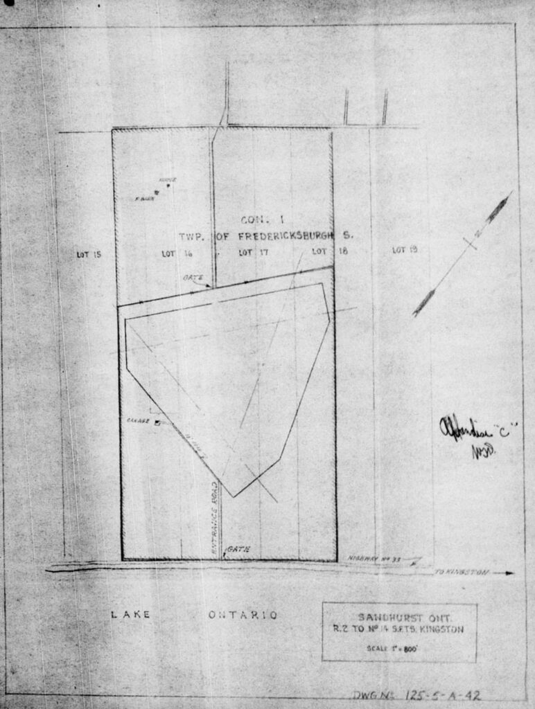
There has been quite a bit of discussion about this aerodrome but I am having a hard time find it right now. Looking at the drawings and maps it appears it was just north of the highway running along Lake Ontario and the site appears to now be occupied by the Lennox Generating Station. A comparison with the township maps for the region would likely result in an exact location as the facility appears to have taken up all of lot 16, 17 and half of lot 18.
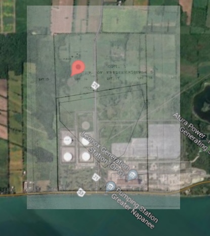
Location – Google Map
For More information – External Links
- Wikipedia
- MilitaryBruce.com – Canadian Military History by Bruce Forsyth
- Township Map
- Aerodrome Disposal File: