RCAF Station Beatton River
General Overview
Base / Station: Beatton River
Province: British Columbia
Dates of Operation or Period of Information:
Units:
- North West Staging Route
- Emergency Aerodrome
Aircraft Flown:
Commanding Officers:
Financial Impact:
Date / Reason for Closure:
Current Status:
Aerodrome information
Extracted from the Air Route Manual, USAAF, United States to Alaska, January 21, 1944
Lat. 57 deg 20’N, Long. 121 deg 38’W (note: this location when typed into google maps is approximately 10-12 km west of the current location of the Beatton River Airport, the location showed on the google map below is the location of the current Beatton River Airport which i believe is one and the same)
Magnetic Variation – 31 deg 30’E
Markings – Area Flagged.
Lighting – Boundary lights and beacon to be installed. Flares available.
Obstructions – None.
Repairs – None.
Radio – Range, Tower.
Accommodations – Barracks for 28 men.
Operated by – RCAF
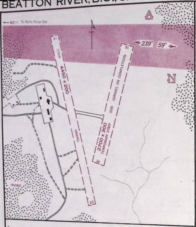
Aerodrome Chart – Air Route Manual – January 1944

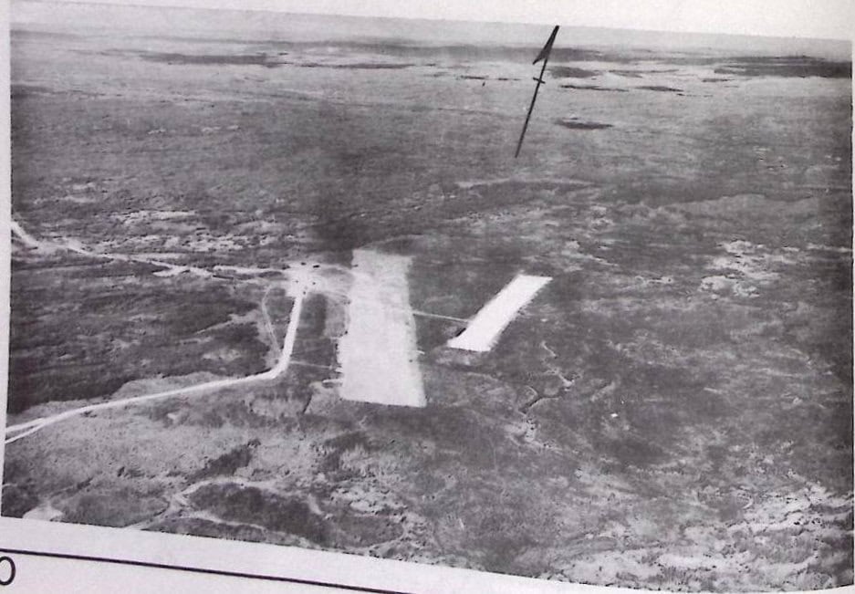
Location – Google Map
Station Magazine
“”
Daily Diary – Links –
1941
1942
Fatalities
This list was compiled from the entries in the Daily diaries of ___ and other sources. The list likely does not include all fatalities of personnel who died while stationed at RCAF Station Beatton River, and likely includes some errors. Currently this list contains __ personnel.
Notable Alumni
Aircraft List
Notes
Related documents:
For More information – External Links
- Wikipedia
- MilitaryBruce.com – Canadian Military History by Bruce Forsyth
- Site Plan:
- Aerodrome disposal files :